Our Trinetra solution combines three digital offerings (i.e., its three digital eyes) together to assist in accomplishing project objectives.
Our Trinetra solution combines three digital offerings (i.e., its three digital eyes) together to assist in accomplishing project objectives.
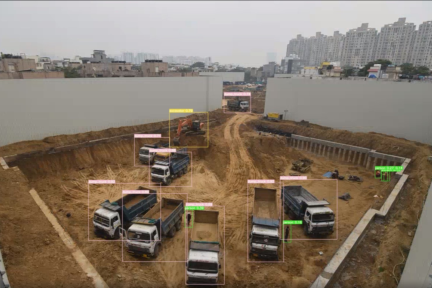
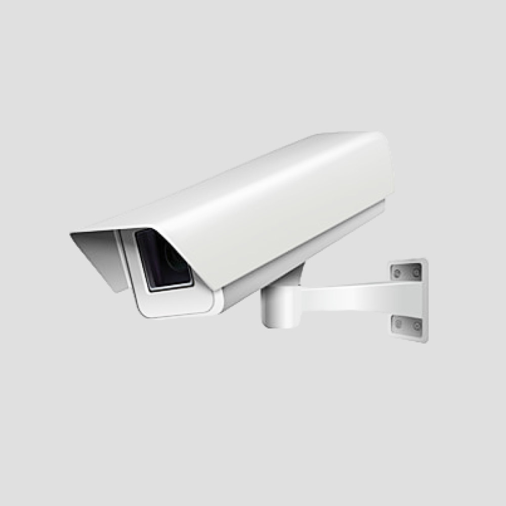
Discover the first Digital eye of Project Trinetra, equipped with cameras that can process images using artificial intelligence. With the help of cutting-edge AI technologies, these cameras can identify workmen, Equipment, and PPE Non-compliance (Hard-hat). It also includes progress comparison, time-lapse recordings, and HD photos. Include smooth connectivity with Procore, BIM, and project planning features as well.
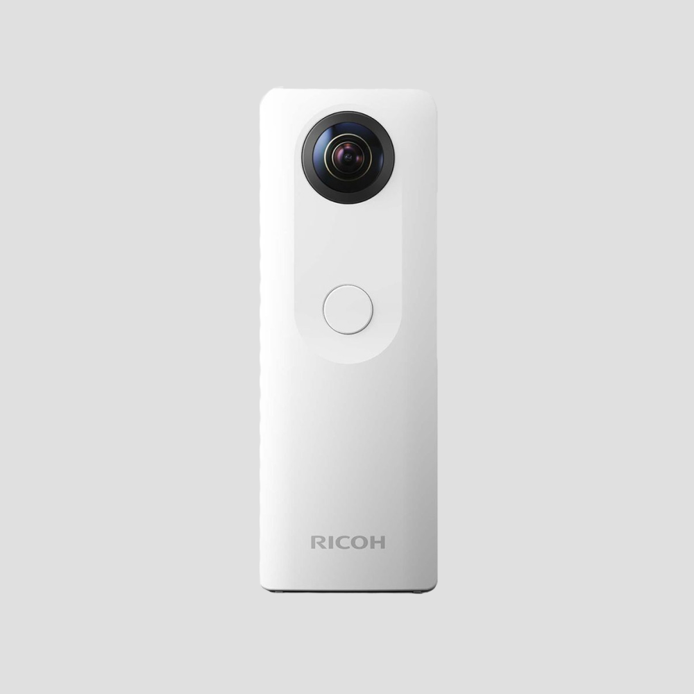
Another Digital eye of the Project Trinetra is 360° Photo/Video tool for Digital surveillance. With the use of periodic 360° photos and videos superimposed on layout designs; this technology incorporates interior tracking. Improved documentation and reporting facilitate remote visualization and issue identification by streamlining status checks.
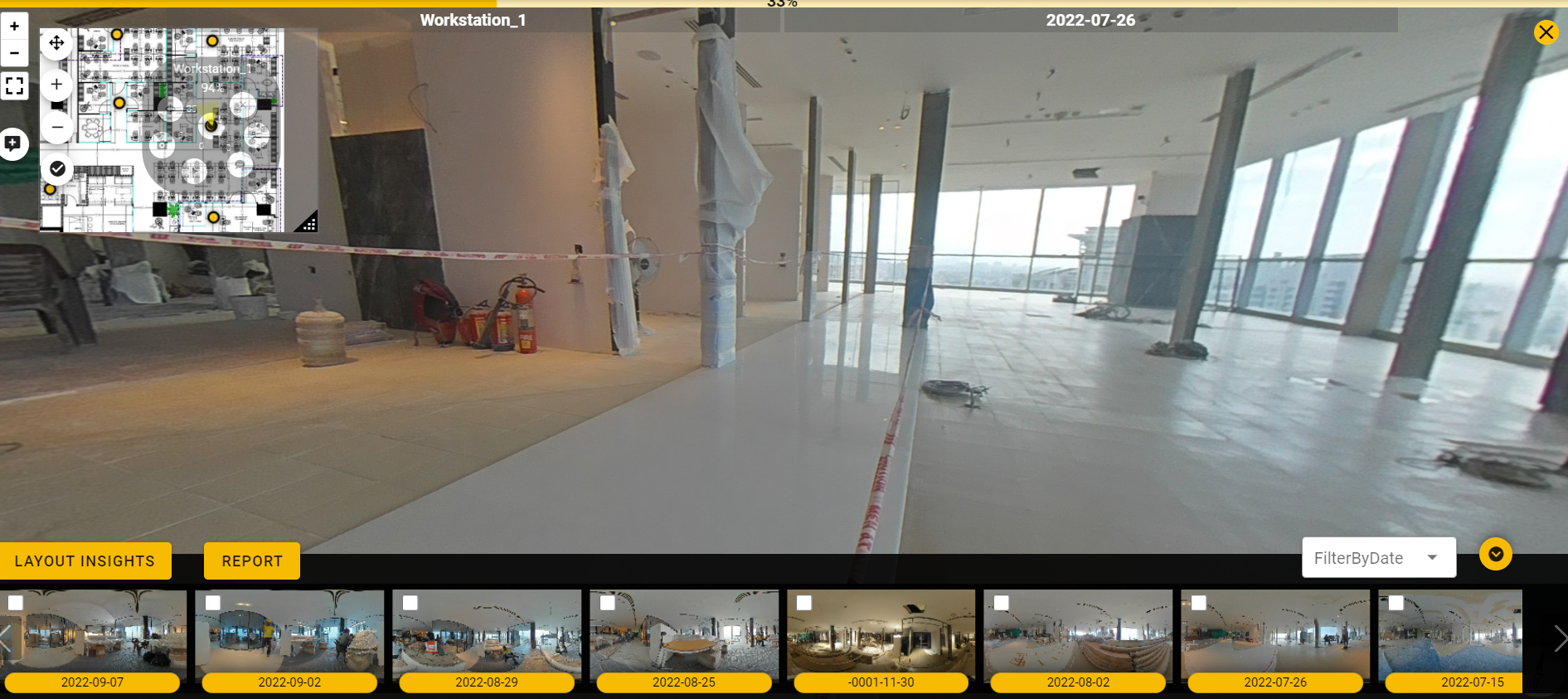 Use the timeline view to obtain historical data quickly and easily for strategic locations on layout plan. Make it simple to access old photos and videos. Use the filter option to efficiently manage extensive collections spanning months and years.
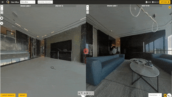 Analyse construction progress by contrasting 360-degree photos taken at different Data dates. By choosing two timeline view photographs and comparing them side by side, you can quickly see changes and ensure complete verification.
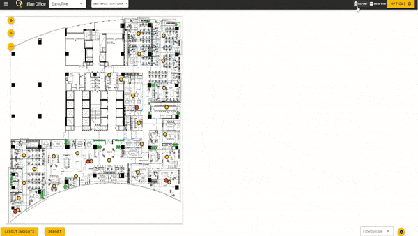 Provide thorough progress reports that include the status of tasks, scheduled deadlines, and the percentage of completion for each section of the layout that has been assigned. This one-of-a-kind report offers a comprehensive summary of the status of construction at the project and floor levels.
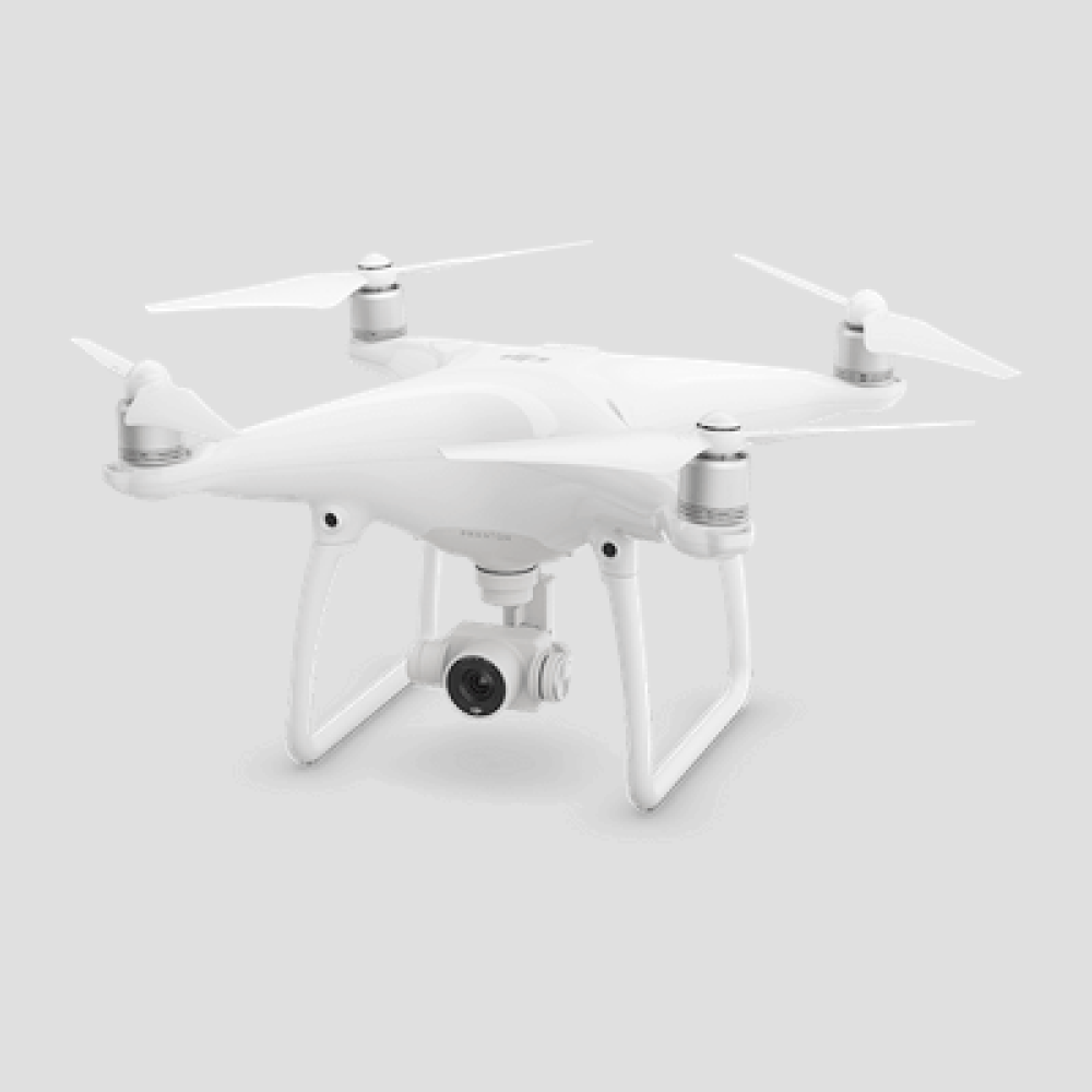
Construction Drone photography for progress monitoring is the third eye of the Project Trinetra. Construction drones provide geotagged photos, videos, and 360° panoramas through an online dashboard, assuring precise assessment of the project and enabling efficient team collaboration for prompt decision-making with aerial visual data.
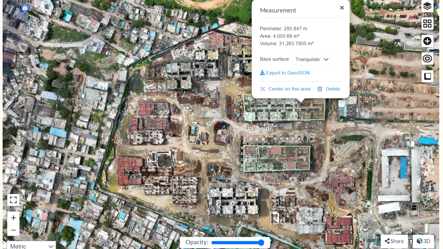 Our drones generate orthophotos by seamlessly combining numerous aerial images, resulting in georeferenced, distortion-free orthomosaics. These precise 2D maps play a vital role in site surveys, monitoring project progress, and verifying compliance with architectural plans.
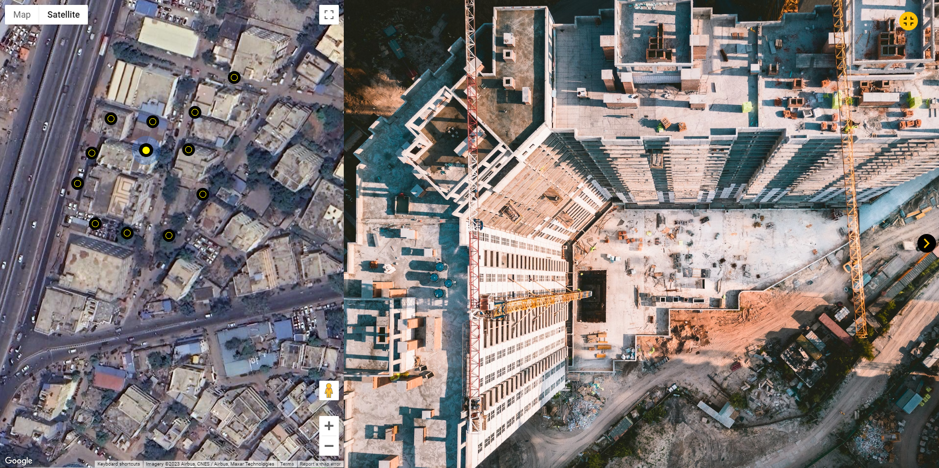 Construction drone imagery is accurately mapped to precise locations. Experience a seamless viewing experience with drone videos displayed on one screen half and corresponding locations on maps on the other half.
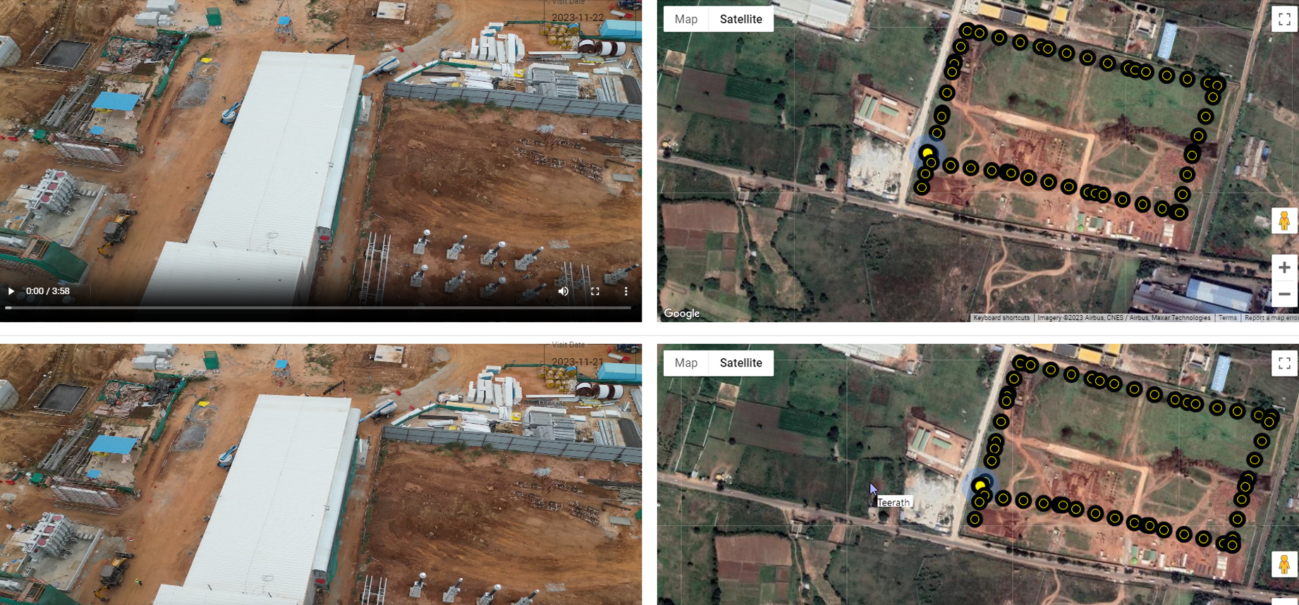 Waypoints are defined locations along a route that provide drone operators with reference markers. Waypoints in drone navigation allow autonomous flights by using predefined map points to ensure consistent path capture over multiple flights. Data collected on the same route on several data dates improves the effectiveness of progress monitoring.